


Belleville Ward 3 Exclave Cemetery, Republic County, Kansas
About
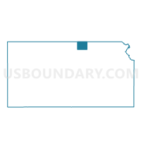
Outline

Summary
| Unique Area Identifier | 586454 |
| Name | Belleville Ward 3 Exclave Cemetery |
| County | Republic County |
| State | Kansas |
| Area (square miles) | 0.07 |
| Land Area (square miles) | 0.07 |
| Water Area (square miles) | 0.00 |
| % of Land Area | 100.00 |
| % of Water Area | 0.00 |
| Latitude of the Internal Point | 39.82879720 |
| Longtitude of the Internal Point | -97.64033490 |
Maps


Graphs
Select a template below for downloading or customizing gragh for Belleville Ward 3 Exclave Cemetery, Republic County, Kansas


Neighbors
Neighoring Voting District (by Name) Neighboring Voting District on the Map
- Belleville Township Voting District, Republic County, KS
- Freedom Township Voting District, Republic County, KS
Top 10 Neighboring County Subdivision (by Population) Neighboring County Subdivision on the Map
- Belleville city, Republic County, KS (1,991)
- Belleville township, Republic County, KS (236)
- Freedom township, Republic County, KS (167)